
Come join Wicked Stones on our 2007 Rock Hunting Tour of Northern Ontario
We did this rock hunting tour back in 2007, so it’s important to note that some of these locations may no longer be accessible.
We’re back!! We had the most wonderful weekend trekking about the forest north of Sault St. Marie, and I’ve decided to post some of our adventure photos. Maybe you are travelling along this route, and you’ll find some helpful info. The pictures you are going see were taken with an old Kodak digital camera, so the quality won’t be super great, but you’ll get a good idea.
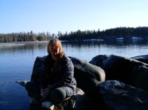
See that blurry girl in the photo there on those interestingly shaped rocks? Yes, that’s me, sitting outside of a cabin that we rented at Montreal River in Northern Ontario. An old friend of mine suggested that it would be a great place to begin our adventures as it’s a gorgeous place to stay with an amazing views. And you might get lucky and even find an agate here. Due to the water colour staining the rocks, I really couldn’t see much. It was quite early in the year, and if you look in the background of the photo, you can still see the ice and snow on the ground.
Our adventure began on Friday morning. I managed to get “just about everything” we could possibly need packed on Thursday (with a lot of effort) and into the back of the truck. One of our plans was to follow some old hints and routes from a book called Geology and Scenery. North Shore of Lake Huron Region.
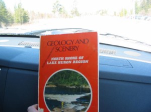
This book is part travel guide and part mineral treasure map, filled with fascinating side trips, local mineralogy and information about old mines throughout the area. It is one book in a series and is not particularly easy to find, but it is well worth tracking down.
I spent a lot of our drive west toward Sault Ste. Marie with my nose buried in its pages, reading interesting bits of information aloud as we travelled. There were so many cool things to learn about places I thought I already knew!
Many of the locations mentioned in the book are on private property. If you decide to visit any of them, please make sure you have the landowner’s permission before entering.
I found this book at the Sudbury Gem and Mineral show quite a few years back, and it’s become one of a set we never travel without now when rock hounding.
FIRST STOP: RYDAL BANK ONTARIO
This is a small town that is about 10 km north of Bruce Mines. It’s very quaint and worth checking out. We were on the hunt for Pudding Stone. If you look around the area, you will see many homes that show off larger boulders with these beautiful red pockmarks, which are easily visible even from the road. A bit of info on the area: there is a prominent ridge that marks an outcropping of the Lorrain Formation, and you can find what is called “Pudding Stone”. This is a quartz jasper pebble conglomerate (or mixture).
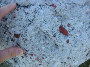
This is a really pretty rock with beautiful dashes of red. The red marks are Jasper. After a bit of chatting, we decided to drive north of Highway 17 towards the dam area. We didn’t find a lot of stones near here, but it’s worth a visit. There were only a few small pieces in the area. It was really neat to look down and find these little goodies here and there while we walked.
We decided to take a side trip towards a high rock formation we could see in the distance. Both of us were curious just what might be up that road.
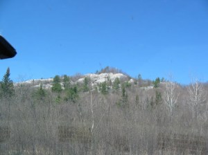
You can see what we were looking at it in the picture. There is a white coloured ridge that is pretty high up on the hills. At this time we didn’t have a car with GPS maps so we were working with a lot of paper, loose pens and empty cups of coffee.
Along the way, we discovered a pretty good side road that goes to the left up towards the hill called Nethery Road. Of course, we took it (checking first to make sure that there were no private signs posted). It was a good thing we were travelling with a 3/4 ton pick up truck, as many of the places we went would not stand up to a regular car. This road led us to Humphry Cemetery. This is a very old site, high up on the hills looking over the beautiful scenery. This is a dead-end road, and you can see the gravel pit we also visited from there. There were some beautiful old headstones but out of respect for the family members, I’m not posting any photos. Some of the dates were prior 1900s. It was a beautiful location.
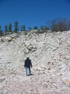
The Gravel Pit – Rydal Bank Area
It was pretty quiet in the area, and no rock trucks or equipment could be found, so we felt okay about continuing the exploration of the area. We did a good check to ensure that there were no trespassing signs as well. At the bottom of this hill was a large gravel pit. We didn’t find a lot of pudding stone here, just the odd piece here and there. We poked around here for a while to see what we could find, but for the most part it was all white stones. Don’t be me – wear good shoes instead of sandals!
Back on the highway, we went, and we went on through to Sault St. Marie. We took a short side trip down Wolf Lake Road (around Batchwana Bay area) and did some exploring. It was more of a look around and not any serious rock hunting was happening. Both of us found it FAR too busy with a lot of dirt bikes and fishermen everywhere, so we turned back on the highway to go further on.
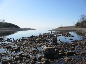
We soon arrived at our cabin near the mouth of the Montreal River. The exposed shoreline you see here is usually underwater, so do not let its peaceful appearance fool you. Water levels and flow are controlled by several dams upstream and can change unexpectedly. If you visit and decide to walk around, stay alert and listen carefully for any change in the sound of the water.
Because our trip took place in early spring, everything was wonderfully quiet and peaceful. We spent a deeply relaxing evening beside the campfire, eating pasta and watching the first stars appear in the clear, dark sky. As the fire crackled beside us, we dreamed about the adventures waiting for us the following day.
The Next Day – Mica Bay
On Saturday, we got up early to head to Mica Bay. This area has what is called the Keweenawan volcanic rock formations in it. Here’s a bit of info: The Keweenawan are principally made up of lava flows and basaltic composition with vesicles (gas cavities) that have been filled with minerals such as agate, amethystine quartz, calcite, chlorite, datolite, epidote, prehnite, thomsite and zeolites. These are really pretty when you see them up close. When you drive past them on the highway, they look kind of reddish, and you don’t see the inclusions. When you stop to take a closer look, they are very interesting and full of neat treasures and cavities that hold things.
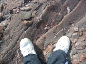
OH LOOK! I’m wearing real shoes this time instead of sandals!! You can see some of the calcite and quartz veins in the rock that I’m standing on in this picture.
Just a bit further down this beach, we stumbled upon a fabulous find. You will see from the next photo how far the water had receded over the winter, so there were a lot of rock treasures just waiting to be found. I was walking towards the shoreline (thinking that I had spotted a REALLY big Lake Superior Agate winking at me near the edge of the rocks). I reached down, only to have the rock I was looking at roll and crush my thumb between it and another rock! OUCH! Thanks, Universe!!
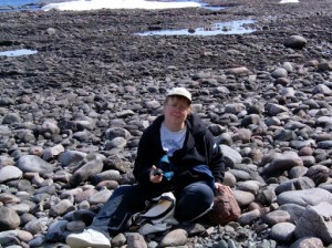
I stood up quickly to nurse a bruised thumb, only to trip and crash onto another pile of rocks right behind me. (Good shoes – always wear good shoes!) I turned around to look at what had tripped me and found myself smack dab in the middle of a pile of Hematite and Jasper! What a find! People on the highway probably heard me whooping for joy!!
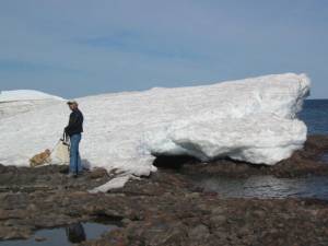
As I sat there in awe, watching the waves roll in near me (knowing that these stones were only recently hid by layers of ice and before that, many feet of water), I got to thinking of Mishi Peshu, the great underwater lynx like creature who lives in the depths of Gitchigumi (Lake Superior). As I turned to look over my shoulder, I could see my other half looking in awe at the great ice bank still resting on the shoreline. You can see it was really quite early to be out rock hunting and very cool outside still.
A bit of history on this: Mishi Peshu is the ultimate metaphor that represents the power, mystery and innate danger that comes from these sacred waters. With razor like spikes on his back, the face of a lynx or panther, and the body of a sea serpent, this creature demanded respect. The Anishinabe offered tobacco and prayer to the creature spirit before they embarked out onto the waters in their canoes. The calm waters of Lake Superior can be quickly transformed into raging squalls and huge waves from the northern, north-eastern, and north-western gales that often suddenly crop up. These gales sweep over the open water, quickly picking up momentum and causing huge waves, some up to 40 feet high. A picture of Mishi Peshu is found at Agawa Bay, Lake Superior National Park, in northern Ontario, north of Sault Ste. Marie. If you are looking for more information on how to visit the park to see this in person? Check out this link that will take you to the Lake Superior Provincial Park site. The Midewiwin Society claimed in 1850 that this pictograph was painted by an Anishinabe shaman, and represents a heroic 4 day crossing of Lake Superior by a war party of five canoes. The author is believed to be a tribal shaman named Myeengun which means “Wolf.” The images are painted using red ochre, a pigment made from the iron ore called hematite, mixed with clay minerals. This is the most famous rock art painting in Canada, according to National Collection Archive sources.
Gargantua Provincial Park
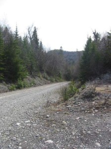
If you have the opportunity to visit this part of Lake Superior’s north shore, Gargantua is well worth the journey. When you turn off Highway 17, a warning sign announces that 14 kilometres of rough, winding, single lane road lie ahead. Take that warning seriously. The gravel road can be challenging, so drive slowly and leave yourself plenty of time. You can see what part of the road looks like in the photo below.
Gargantua is one of the main access points for the Coastal Trail system. If you plan to hike here, be prepared for one of the most physically demanding trails in the park. The route follows Lake Superior past rocky beaches, rugged shoreline and high cliffs, stretching from Agawa Bay north to Chalfant Cove.
Gargantua also has a fascinating history. Its sheltered location created a natural harbour that supported fishing and logging during the early 1900s. The community was busiest during the 1930s and 1940s, when the only way to reach it was by boat.
Gargantua is AMAZING!! There are miles and miles and miles of the most beautiful and well-hidden scenery on this part of the shore. It is a rough stop to get into, so there were only a few folks there when we arrived (some were set up for camping on the shore).
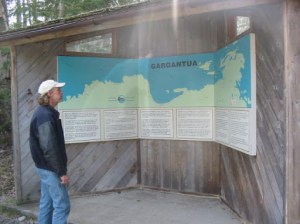
The beach is beautiful with a mixture of sand and stones. Yes, that’s a picnic table buried under sand up there.
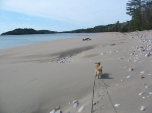
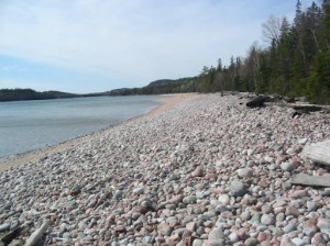
The shoreline was covered with everything from tiny pebbles to enormous boulders in an incredible variety of colours, shapes and sizes. Because this area is within an Ontario provincial park, we did not collect any stones. We were more than happy to spend hours poking around, examining our discoveries and enjoying the beautiful spring afternoon.
By the time we returned to Montreal River, we were both tired, hungry and ready for a good night’s sleep. The following morning, we packed the truck and began the drive back to Sudbury. Of course, we could not resist making a few more stops along the way to search for Puddingstone near Bruce Mines and the shores of Georgian Bay. We came home with a pocketful of little samples that now have a special place in our gardens.
Did we find any Agates on this trip? Sadly, no. But we did bring home a few incredible pieces of Hematite Jasper, some beautifully rounded stones for painting and plenty of wonderful memories.
More importantly, the trip gave us a chance to step away from our busy, hectic lives and spend a few peaceful days surrounded by rugged shorelines, quiet forests and the endless beauty of Lake Superior. We may not have found the Agates we were searching for, but the adventure was absolutely worth it.
And if you love hunting and searching for rocks in the wild? You might also enjoy seeing what they look like transformed into wearable art and jewelry. I handcrafted crystal and gemstone jewelry, and some of our pieces are natural stones that are found right here in Northern Ontario. If you are interested, come have a look at Wicked Stones.
Cheers and thanks for reading! Be safe in your rockhound travels!


I enjoyed your blog. I think you should share links to it of fb lapidary and mineralogy rock hounding groups. (Maybe you already have lol) I live in Bruce Pennisula. Heading north to SSM area looking for quartz? Any suggestions?
LikeLike
Hello Karen. Thank you so much for your kind comment on my blog. Honestly, I’ve been amiss in updated and need to get back on that.
I will check my books here and see if there’s anything helpful in that area but I did do a quick search on Minedat (great site by the way for info).. and found this for you
This is close to Sault St Marie…: https://www.mindat.org/locentry-694789.html
This guy has some awesome videos: https://www.youtube.com/channel/UCEcWqnK5ufQ3sUonColo2Tw
Here’s a lot of locations along 17 west from Sudbury to the Sault: https://www.mindat.org/locentries.php?p=14233&m=3337
If you are coming up 69 north and you turn off on the 537 (on your right) near Wanup and travel about 1/2 km (keep going right off the highway) you will see quite a large rock cut. There is quartz in there (not points tho).. but use caution as the rock face has fallen in the past and has recently been worked on. It’s mixed with pink plageoclase (quite pretty!), mica and some other minerals scattered here and there to discover like feldspar and biotite. There is a old mine listed on Mindat just past the rock cut going down the hill on your left but it is on private property and monitored so access is not permitted there without getting permission. Stick to the rock cut.
Great little post to check out with directions but it’s going a little off the traveling route you mentioned; https://www.cbc.ca/news/canada/sudbury/treasure-hunting-for-white-quartz-red-granite-1.2742004
http://www.geologyontario.mndm.gov.on.ca/mndmfiles/pub/data/imaging/R131//r131.pdf A very good read with mineral information from the Espanola area (not sure if you are coming from the Ferry or up 400 North)
These are some great starting points. I hope this helps…
Have an awesome and safe trip!
Vikki
LikeLike
Great blog. So you did not find any agates? From some of the Youtube videos that I saw one would think there would be lots of agates on the shores of Lake Superior. Mind you those videos were mostly taken on the American side in Michigan and Minnesota. I would have still figured that it’s the same lake….there’s gotta be some agates on the Ontario side isn’t there?
LikeLike
Hi James.. Wow.. I fell into a sink hole there and have not been replying.. sorry about that..
Sadly, that trip coughed up Zero Agates.. I did find one on a prior trip. Much of the area up there is either difficult to get to, on Provincial Park land or on Private land. I know there are places I’ve talked to people about where they can be found and I’ve seen stashes from others who have found them, but I don’t seem to have that lucky streak when it comes to Agates.
I’m hoping this spring will be another fresh trip up into the area.
Cheers
Vikki
LikeLike